
Browse Items (13649 total)
Sort by:
Fire northeast of Trout Lake, July 1961, Sioux Lookout
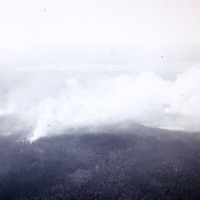
Fire northeast of Trout Lake, July 1961, Sioux Lookout. Photograph depicts a forest fire northeast of Trout Lake. The photograph is in black and white.
Otter aircraft, Jake Seiget and Erling - Sioux Lookout
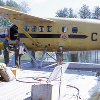
Otter aircraft, Jake Seiget and Erling - Sioux Lookout. Photograph depicts Jake Seignet and Erling, as well as a child, standing next to an Otter Aircraft from the Ontario Department of Lands and Forests (Ministry of Natural Resources).
Sioux…
Sioux…
Graph - depth om x no of burns
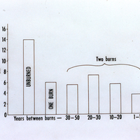
Graphs for Fire Damage Study showing the relationship between the depth of surface organic layers in centimeters and years between burns, years since last fire, and number of observations.
Graphs - pH x years since burn
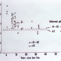
Graphs showing the relationship between pH levels and years since the last fire for Fire Damage Study.
Examples of profile description
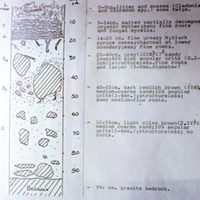
Examples of profile descriptions for soil samples showing depth in centimeters, location and material descriptions and diagrams. Sample shown is from Trout Lake in Bear Trap Bay and details soils composed of litter, mosses, organic matter, roots,…
Location of study areas in relation to burns
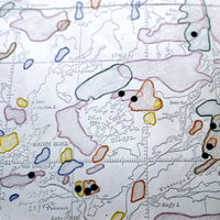
Map showing the location of study areas in related to burns for areas near Red Lake, Ontario.
Title - Effects of fire on soils
Slide pack title page, Effects of fire on soils.
Location maps
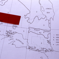
Location maps for soils in Northern Ontario showing distribution of organic soils, soils of the Precambrian Shield and level clay plains.
Uchi Lake - sandy loam, till/bedrock - 1942 & 1959 fires
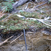
Soil cutaway showing layers of sandy loam, till and bedrock after 1942 and 1959 fires, Uchi Lake Ontario. Photograph shows close-up area with soil layers and a spade. Some top vegetation is visible amidst fallen trees from fires.
Soil type: #59
Soil type: #59
Uchi Lake - regeneration - PNb - 1942 & 1959 fires
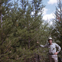
Regeneration of PNb after 1942 and 1959 fires, Uchi Lake Ontario. Photograph shows man standing beside regrowth of trees in an area with some rock and fallen trees.
Soil type: #59
Soil type: #59